We were coming off a nice stay in Louisville, Mississippi where we had spent a few days catching up on stories and the business parts that pay the bills. Ready to get back on the road and explore more history of Mississippi we hit the road and found ourselves in Philadelphia looking for one of Kathy's passions...Old General Stores.
 Williams Brothers Store doesn't disappoint if your looking for an historic general store still in operation. From the bins of beans and seeds outside, to the fresh cut bacon inside, this place has a little bit of everything and is no small operation. Established in 1907 by brothers Amzie and Brown Williams, it still holds that old charm of yesteryear. According to an article in the Mississippi Business Journal, it looks pretty much as it did in 1939 when it was featured in National Geographic.
The article from last August points out that Williams Brothers employs up to 60 at the store, and sells everything from red rind Wisconsin hoop cheese to denim overalls. They even have some designer clothes. Today the store is still in the family and going strong. It has been a long time since I've seen a butcher actually slicing bacon for a customer. Need to get out of big chain rut and visit places like this more often.
After Philadelphia, we hooked west to get back on the Natchez Trace. The River Bend Picnic area (Mile Post 122.6) provided a nice stop to learn about the Pearl River. Named the "River of Pearls" by French explorer Pierre Le Moync, Sieur d'lberville, the Trace avoided the marshy lowlands of this area by following the ridge between the Pearl and Big Black Rivers for 150 miles. The last 75 miles of the rivers course have served as a boundary between Mississippi and Louisiana since 1812.
Just a half mile away (mile post 122), you can really see why the Trace avoided lowlands. Here, you can take a 20 minute walk through a water tupelo/bald cypress swamp, which we found quite "magical". Cypress Swamp was created when the Pearl River changed its course and left an abandoned river channel. Water tupelo and bald cypress trees can live in deep water for long periods of time. In fact, some of the living Cypress trees may have seen the passage of Hernando de Soto nearly 500 years ago. During periodic low water, seedlings of these trees took root and the aquatic forest is the result. As the channel fills with silt and vegetation, other trees will gradually take over, but not for several hundred years.
Kathy and I loved this stop for it's natural beauty, and recommend you take time for a leisurely stroll yourself. Although we did not see any, alligators are sometimes seen here. They look like floating logs with nostrils and mostly hide or sleep. Of course, that meant every log I looked at in the water was suspect, and I probably wasted quite a bit of digital space on the camera. I'm writing this in the blog so when I look at the photos years from now I won't wonder about my "floating wood obsession". A sign along the trail warns not to throw food to them or they may lose their fear of humans and become aggressive.
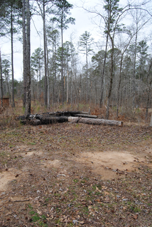
After Cypress Swamp we made another "mound" stop at Boyd Site (mile post 106.9). These Indian burial mounds were built up to 1200 years ago. Archaeologists indicate there was a house here sometime around 500 A.D., and that pottery found in the mounds date back before 700 A.D. While we are enjoying the burial mounds along the trace, we are finding that, after a few, a mound is a mound. The history is fascinating though.
(Read more about the Mound Builders of Mississippi)
As we left Boyd Site we noticed traffic getting heavier as we were about to cross the northwest part of Jackson. We somehow missed Brashears Stand and another piece of Old Trace (mile post 104.5). The stand was advertised in 1806 as a "house of entertainment in the wilderness", and part of the original Trace is nearby. Osburn Stand (mile post 93.1), was opened by Noble Osburn in 1811 but by the early 1820's, when Jackson was founded, traffic shifted away from this part of the Trace. As with many of these stops, only a marker remains.
A better stop for us, being the cemetery nuts we are, was Cowles Mead Cemetery (mile post 88.1). Mead came from the east for the opportunity the Mississippi Territory had to offer. In addition to owning a tavern on the Old Trace near Natchez, he also held several political offices, including acting governor in 1806. During this time he ordered the arrest of Aaron Burr for treason but the former Vice President was acquitted Mead followed the growth of the state and moved to the Jackson area, where here he built his "Greenwood" estate. Little remains today as the estate burned after his death during the Civil War. But the family cemetery remains.
Askew Landing near Edwards, MS
We exited the Trace at Raymond to find our next long term stay. Kathy and I found a gem of an RV Campground hidden off back in the woods near Edwards, Ms. Askew Landing is in a perfect location for us, just 20 miles outside of Vicksburg and within driving distance for more Natchez Trace and plenty of other great Mississippi history. And there's great history right here at the campground, which is part of Bridgeport Plantation.
Established by Duklet Askew in 1859, he and his brother traveled from North Carolina to Mississippi searching for land to build a cotton plantation. Duklet bought 2,000 acres northeast of Edwards along the old Bridgeport Road and named it Bridgeport Plantation. He began by clearing more than 500 acres, farmed cotton, and built and operated a ferry across the Big Black River. Some time later, he built a cotton gin and general store close to the ferry on Bridgeport Road.
Life on the plantation was interrupted in 1863 by the Civil War as Confederates, fleeing after the Battle of Champion Hill back towards Vicksburg, were involved in skirmishes. The Confederates used Askew's Ferry to cross the Big Black River, then destroyed the ferry so that the pursuing Union troops couldn't use it. Nearly a month later, during the Operations in Northeast Mississippi, another skirmish took place at the plantation when a a Confederate cavalry force unsuccessfully challenged the Union picket guarding General Grant's eastern line.
See our full story on Bridgeport Plantation and Askew's Landing HERE.
Askew Landing RV Campground is truly one of Mississippi's best kept secrets. Listed on the National Register of Historic places with the camp ground sitting in the center of 300 wooded acres, it is easy to access off I-20, but, far enough away to shield its visitors from the sounds of nearby traffic or passers-through. With plenty of history to explore within driving distance, and due to 'beyond our control' circumstances, this wound up being our longest stay at any campground (almost 2 weeks). Things happen when you are RV'ing, and we were lucky it happened here. (See RV Campground reviews at the end of this article)
Day Trips from Askew
Over the course of our stay at Askew Landing we took several day trips to nearby history. One of our first excursions from the campground was the nearby Battle of Champion Hill, southeast of Edwards. This is not your typical "let's go see the battleground". There are markers scattered about that you have to know of ahead of time, or a private tour of the Champion Hill Battlefield can also be arranged with a descendant and owner of the property. ($25/person, minimum of two as of February, 2013). By all accounts, we've heard this is an excellent tour given by the great-great grandson of the original owner of the property.
Being the explorers we are though, and having multiple destinations in a day, we opted to find what we could "off private property", and found quite a bit. The Battle of Champion Hill, May 16, 1863, is described as a critical battle that could have swung the war to the Confederates. In fact, if Confederate forces had been victorious, Vicksburg would never have fallen, as General Ulysses Grant's Vicksburg campaign could have been stopped. Instead it was a disastrous day for Confederate Lieutenant General John Pemberton that put his troops on the run, and allowed Grant's momentum to continue.
Of the Champion Hill area, the battlefield and some of the original roads are very well preserved. However, there are no original buildings. Thousands of acres of the core battlefield are privately owned and another 800 acres of the outlying area is owned by the State of Mississippi. An additional 402 acres have been protected by the Civil War Preservation Trust through conservation easements and land purchases. There are hopes that parts of these properties may become an extension of the Vicksburg National Military Park.
Read our full story on the Battle of Champion Hill, including a link to a points of interest map of the battleground HERE.
A few miles down Highway 467 from Edwards sits another battle site in and around the historic town of Raymond. Just off the Natchez Trace, Raymond was established in the late 1820's and at the time was the Hinds County Seat, before it moved to Jackson. In addition to Civil War history surrounding the Battle of Raymond on May 12, 1863, you'll find find plenty of small town charm, along with historic buildings, such as the 1859 courthouse built in southern Greek revival architecture.
At Carter Cemetery just south of town we found a Confederate Cemetery, one of several we are running into. Kathy and I had never really dived into how the Union and Confederate's handled their fallen until now. Really, as American's, I guess some of us assume that National Cemeteries would be for Confederates and Union alike. That's not the case, as you have to keep in mind that we were not 'one' nation at the time. In fact, it wasn't until 1906 that the Federal Government became involved in permanently marking Confederate graves.
There's some very interesting history in how our National Cemeteries came to be and how the Confederate fallen were handled. Read "The Evolution of National Cemeteries", courtesy Kelly Merrifield for the National Park Service, HERE.
After Raymond, Kathy was on a mission to find an historic Church. But, as we have many times before, our mission becomes distracted by bright shiny objects, like another old Country Store that we literally stumbled upon in the very small town of Learned, MS. Gibbes General Store was established around 1899. Still in the family, this is another great stop for history and nostalgia buffs like us.
We had a very pleasant visit with Chip Gibbes, the current generational owner, who told us about his families history in Learned dating back to 1836. As the only business left in the town, Gibbes Country Store is a combination 'museum' of sorts, as well as an active store and, some nights, even a steak house. We tried, but couldn't make it for what we understand to be one heck of a dinner service, but we did enjoy the visit and the old historic building. And to top it off, we found out Chip is a second cousin of Dan Askew at Askew's Landing. Yep, 'small world' applies in Mississippi too.
Our day trip concluded with a visit to the Coker House, part of the Battle of Champion Hill off highway 467. The original is gone, just within the past few years, but there is a reconstructed home at the site now with many interpretive signs explaining the history of the home, it's occupants and its role in the battle. On the southern edges of the battle, it sustained fire from both sides, as well as serving as a field hospital after the battle. Overwhelmed a bit from all our Civil War history, I couldn't take my eyes off a peculiar tree in front of the house. Not a lot of words to describe its character, so I'll just let your imagination go with the photo.
Valentines Day Trip with more Trace, Fried Chicken, Historic University, Ghost Town & Ruins
Did I mention how much it has rained since we've been in Mississippi? And we're not talking your passing thunderstorm either. Kathy and I had our first experience of being stuck in the trailer for 3 days at Askew's Landing, watching the pond behind our trailer devour the road into the campground and inch closer and closer to our electric box. At least we know this amount of rain is abnormal for February, and the alternative back home in Warsaw, MO is lots of snow.
So it was with great relief that Valentines Day turned out to be one of those 'blue sky' sunny days, perfect for a day trip on the Natchez Trace and more. We first headed south of Edwards to Old Port Gibson road, then over to the town that is no more, Rocky Springs, just off the Natchez Trace. Here you'll find the Rocky Springs Church, built in 1837. Still active, it was built by Methodists in the town, which up til then, had been a station for a circuit riding preacher who stopped here only once or twice a month.
Early travelers along the Trace called the area "the Rocky Spring", and as the rural community developed in the late 1790's, several businesses were established, including a post office in 1821. The town boasted a population of over 2,600 in 1860, 2,000 of which were slaves, but that would be its peak. In addition to the ravages of the Civil War, a yellow fever outbreak in 1878 would devastate the population, and then in the 1900's the boll weevil struck their cotton crops. Rocky Springs would rapidly decline after that, and it's last store closed during the 1930's. Today a short interpretive walking trail will take you to the church, its cemetery and some interesting artifacts, like an old safe which could have belonged to a store, sitting on the side of the hill.
At Rocky Springs we hooked back up with the Natchez Trace and, after missing Owen's Creek Waterfall at mile post 52.4, our first stop was Grindstone Ford (mile post 45.7). This ford marked the beginning of the wilderness of the Choctaw nation and the end of the old Natchez District. Fort Deposit nearby was a supply depot for troops clearing the Trace in the early part of the 1800's, and troops were assembled here during the Burr conspiracy allegedly to separate the Western States from the Union.
In addition, Riverboatmen on foot and horseback crossed here after floating cargo down from Ohio River to New Orleans and Mississippi. Soldiers came here while protecting the Natchez District from British and Spanish threats. And Daniel Burnett's stand stood here. Burnett was a principal negotiator with the Choctaws, and framer of the Mississippi state constitution. For many, this was the line between civilization and the wilderness. If you want to see the original road, this is another great stop, with a section of sunken Trace along with a small graveyard dating back to it's active years.
Also nearby, Magnum Mound, another example of the Mississippi Mound Builders, tells us much about the people of the late prehistoric period. The Plaquemine culture included the ancestors of the modern tribes of Mississippi and Louisiana. It was a society with elaborate agriculturally oriented religious ceremonies. From the burials on this mound, it is known there is a high infant mortality, and upon the death of a chief, a brutal ritual was enacted in which his retainers were slain and buried with him.
We exited off the Trace near Loreman for the "Windsor Ruins Loop Route", a 32 mile long loop through Alcorn and Port Gibson, Mississippi providing a number of interesting stops. The loop is comprised of 20 miles along Mississippi Highway 552/Rodney Road, 7 miles along the Natchez Trace Parkway from milepost 30 to 37 and five miles through the town of Port Gibson and back to the Trace.
We didn't follow the exact route promoted, and first on our agenda was lunch at the Old Country Store in Loreman, on Highway 61. The building started as a General Mercantile store in 1890. Built by brothers M. Heiman, L. Joseph and R. Lehman Cohn who were already successful merchants in Clifton, Ms since 1875, the store in Lorman continued in the Cohn family until 1956. It was renamed the Old Country Store in 1964 by then owner Enest T. Breithaupt, who had been a long time employee of the Cohns'. Breithaupt and his wife Ruth ran the store for 30 years until Ernest's death in 1995.
In 1996 the contents of the building were auctioned off and the building refurbished, opening back up in 1997 as a restaurant. Today, along with walls of memorabilia, travelers along Highway 61 stop in for Arthur Davis' famous 'Heavenly Fried Chicken". Mr."D", as he is known, entertains guests regularly with his song about Grand Mama's cornbread, and cooks up a mighty fine all-you-can-eat lunch buffet. We found Mr. "D" and the employees service to be excellent, entertaining and down right fun. After serenading us, Arthur even gave me a rose to give to Kathy for Valentines Day. As for the food, this is prime southern cooking at its finest. Yes, the chicken is great, but I personally loved the cornbread even more.
After wiping our chins and taking in the memorabilia at the store, we headed back onto highway 552 and entered the grounds of historic Alcorn University. It should be noted that you must pass through a security gate here, but the guard on duty was extremely nice and accommodating as we wanted to get some pictures of some of the historic buildings.
Alcorn is the oldest public historically black land-grant institution in the United States, and the second oldest state supported institution of higher learning in Mississippi. It began in 1830 as Oakland College, founded by Dr. Jeremiah Chamberlain. An ardent Unionist and Whig, Chamberlain was assassinated on campus in 1851 by a secessionist, and after a few years of decline, Oakland College closed its doors at the beginning of the Civil War. The property was sold to the state afterwards, and in 1871 Alcorn University was established to provide higher education for freedmen. Named for James L. Alcorn, the state's governor at the time, at first it was exclusively for black males. However in 1895 women were admitted, and since that time it has continued to grow and educates over 4,000 students from all over the world. The oldest building on the campus is the Oakland Chapel built in 1838.
Kathy and I love Ghost Towns, and our next stop was way off the beaten path. 4.8 miles southwest of Alcorn you'll find Rodney. Now, we took "College Road", a dirt road that exits out the back of Alcorn University to Rodney Road, but most would want to get there via Rodney Road from Loreman. With very few residents today, Rodney was once so important that it almost became the capitol of Mississippi. In the 1860's it boasted a population of 4,000 and was the busiest port on the Mississippi River between New Orleans and St. Louis. However the river changed course, forever altering the fate of the town, and its population decreased to its ghost town status of today.
Careful not to intrude on anyone's private property, we took in the old buildings and abandoned stores. There are a couple of old churches in town, including the Presbyterian Church. Chartered in 1828 as the Church of Petit Gulf, it was shelled by the Gunboat "Rattler" when Federal sailors were captured by Confederate cavalry while attending Sunday services on September 13, 1863. Above the top middle window you may be able to make out the cannon ball stuck in the wall.
See our full story on Rodney Mississippi (COMING SOON) HERE.
From Rodney we headed back to Highway 552 to see the Windsor Ruins. Smith Coffee Daniell II, successful cotton planter, completed construction of Windsor in 1861. The basic style was Greek Revival, but with added details borrowed from Italianate and Gothic architecture. The Windsor house contained 23 rooms, with an above ground basement, two residential floors and an attic. A cupola, where you could see the Mississippi River, was centered on the top of the roof.
Daniell, who owned over 20,000 acres of plantation land in Mississippi and Louisiana, died in April 1861 only weeks after completing the mansion. His wife and children continued to live here, but were left to suffer the loss of a large part of the family's holdings during the Civil War. Leading up to the Battle of Port Gibson in the spring of 1863, Confederate troops used the roof observatory as a lookout as General Ulysses S. Grant's army crossed the Mississippi River. After the battle the mansion was used as a Union hospital and observation post, thus sparing it from being burned by Union troops. Unfortunately, on February 17,1890, a house guest left a lighted cigar on the upper balcony and Windsor burned to the ground. Everything was destroyed except 23 of the columns, the balustrades, and the iron stairs. The Daniell family donated the ruins to the state in 1974.
There's more to see on this Windsor loop before reaching Port Gibson. See our Natchez Mile points of interest Mile posts 31 to 60 HERE.
After Windsor we pulled into the historic city of Port Gibson. This bustling town near the Gran Gulf Nuclear Power Station, is Mississippi's third oldest settlement, being occupied in 1729. Most of Port Gibson's historic buildings survived the Civil War because General Ulysses S. Grant believed the city "too beautiful to burn". Historic Church Street through the middle of town is lined with antebellum homes and church buildings, along with the beautiful Claiborne County Courthouse. The Battle of Port Gibson in early May of 1863 was a turning point in the Confederates ability to defend against amphibious attack.
Plan on a couple of days in Vicksburg
Although we had driven through Vicksburg on the way back from our Valentines day trip, we didn't stop as we wanted to dedicate a full day to the city. In fact, to really do Vicksburg, you will need a couple of days, as there is a lot to explore in addition to Vicksburg National Military Park. Like the Biedenharn Coca-Cola Museum. While Dr. Pemberton may have created his magic elixir in Atlanta back in 1866, it was Jospeh A. Biedenharn who first brought it to the people outside of Soda Shops.
In 1894, Biedenharn was so impressed by the growing demand for Coca-Cola at his soda fountain in Vicksburg that he installed bottle machinery in the rear of his store and began to sell cases of Coke to farms and lumber camps up and down the Mississippi River. He was the first bottler of Coca-Cola. The museum is in the very same Soda Shop in historic downtown. And for the record, all traces of Cocaine were removed from Coca-Cola in 1903, but of course they kept the coca flavoring. Today, the Biedenharn Coca-Cola Museum is owned and operated by the Vicksburg Foundation for Historic Preservation.
In addition to the many other historic businesses and buildings, nearby you'll find the Motor Vessel Mississippi IV, a diesel-powered all steel ship that the Corps of Engineers used as a towboat and inspection vessel for the Mississippi River Commission. It served from 1960 to it's decommission in 1993, and today provides visitors the opportunity to come aboard, learn and explore.
The vessel is located at the Lower Mississippi River Museum and Riverfront Interpretive Site. This is a must stop on your outing to Vicksburg, regardless whether you tour the ship. The Museum covers the history of Vicksburg, its role on the mighty river, and much more. Here we learned how the flood of 1927 resulted in hundreds of thousands displaced from their homes and unable to return for nearly 8 months after the rains had begun. It was the final motivation for many African American families to leave Vicksburg and relocate to other cities like St. Louis, Chicago and Detroit. For landowners, they viewed this migration as a loss of labor, and used "forced work camps" to make sure their labor remained in tact.
Markers for the Battle of Vicksburg can be found scattered in several locations around the city, but your primary Civil War stop is Vicksburg National Military Park. A drive through this beautiful landscape will wind you through monument after monument, dedicated to the men who fought in this critical turning point in the War. The Siege of Vicksburg, part of Union General and later President Ulysses Grant's Vicksburg Campaign, started in May of 1863 and would last until the Confederates surrender on July 4. The fall of Vicksburg that Summer, along with the defeat of Confederate General Robert E. Lee at Gettysburg, were critical turning points for the Union that would lead to overall victory over the Confederate States of America.
Being from Missouri, one monument in particular held special meaning for us. The Missouri Monument at the Battlefield at Vicksburg, Mississippi reminds us that the Civil War was not a struggle to fend off a foreign nation, but a war of Americans fighting Americans.
Here, Confederates from Missouri fought Union soldiers from Missouri. At Vicksburg - and across every Civil War battlefield - men who had once been friends faced off as enemies. Neighbors and even family members found themselves on opposite sides, fighting for different ideals.
The inscription at the bottom of the monument reads "To commemorate and perpetuate the heroic services, the unselfish devotion to duty, and the exalted patriotism of the Missouri soldiers, Union and Confederate, who were engaged in the campaign, siege and defense of Vicksburg."
The Military Park and all other notable Civil War battle sites around the city will take time for you to explore, so plan on a dedicated day or two and enjoy history at Vicksburg, MS.
See our full article on the Battles between Jackson and Vicksburg HERE.
Next travel blog, we explore a little more around Askew Landing and Edwards area along historic Highway 80, then finally made our way south to the beautiful city of Natchez.
In the meantime, we'll be adding more to the Winter 2013 Photo Gallery HERE and via this slide show.
______________________________________________________________
Related RV Park Reviews
Askew's Landing Campground - Extreme southern hospitality. Pet and family friendly. Can't say enough good things about Dan and Edna Askew and their staff. Making sure the roads were good and customers taken care of. Historic location (marker on site). Great WIFI, laundry facility and small store in office make it very convenient. Beautiful location, hidden off the beaten track of I-20 and Edwards. On a large pond/small lake with plenty of wildlife. Between Jackson and Vicksburg with lots of history around the area to explore. Beyond the small on-site store, shopping not to far down I-20 in either direction, and a couple of smaller stores in Edwards. We gave this campground 9 out of 10 and that's just because we haven't found "paradise" yet. Not a "Passport" site" but that didn't matter with the weekly rates. We highly recommend this RV campground.
(Note: We use RV Park Reviews. Traveling in a 22' Travel Trailer. All electric 30 amp or more unless otherwise noted).
 Williams Brothers Store doesn't disappoint if your looking for an historic general store still in operation. From the bins of beans and seeds outside, to the fresh cut bacon inside, this place has a little bit of everything and is no small operation. Established in 1907 by brothers Amzie and Brown Williams, it still holds that old charm of yesteryear. According to an article in the Mississippi Business Journal, it looks pretty much as it did in 1939 when it was featured in National Geographic.
 |
| Williams Bros Store, Philadelphia, MS Still slicing fresh bacon since 1907. |
After Philadelphia, we hooked west to get back on the Natchez Trace. The River Bend Picnic area (Mile Post 122.6) provided a nice stop to learn about the Pearl River. Named the "River of Pearls" by French explorer Pierre Le Moync, Sieur d'lberville, the Trace avoided the marshy lowlands of this area by following the ridge between the Pearl and Big Black Rivers for 150 miles. The last 75 miles of the rivers course have served as a boundary between Mississippi and Louisiana since 1812.
 |
| Cypress Swamp on the Natchez Trace |
Kathy and I loved this stop for it's natural beauty, and recommend you take time for a leisurely stroll yourself. Although we did not see any, alligators are sometimes seen here. They look like floating logs with nostrils and mostly hide or sleep. Of course, that meant every log I looked at in the water was suspect, and I probably wasted quite a bit of digital space on the camera. I'm writing this in the blog so when I look at the photos years from now I won't wonder about my "floating wood obsession". A sign along the trail warns not to throw food to them or they may lose their fear of humans and become aggressive.
 |
| Boyd Mound on the Trace |
(Read more about the Mound Builders of Mississippi)
As we left Boyd Site we noticed traffic getting heavier as we were about to cross the northwest part of Jackson. We somehow missed Brashears Stand and another piece of Old Trace (mile post 104.5). The stand was advertised in 1806 as a "house of entertainment in the wilderness", and part of the original Trace is nearby. Osburn Stand (mile post 93.1), was opened by Noble Osburn in 1811 but by the early 1820's, when Jackson was founded, traffic shifted away from this part of the Trace. As with many of these stops, only a marker remains.
 |
| Cowles Mead Cemetery |
Askew Landing near Edwards, MS
 |
| Welcome to Askew's Landing |
Established by Duklet Askew in 1859, he and his brother traveled from North Carolina to Mississippi searching for land to build a cotton plantation. Duklet bought 2,000 acres northeast of Edwards along the old Bridgeport Road and named it Bridgeport Plantation. He began by clearing more than 500 acres, farmed cotton, and built and operated a ferry across the Big Black River. Some time later, he built a cotton gin and general store close to the ferry on Bridgeport Road.
 |
| Askew's Landing is an historic site |
See our full story on Bridgeport Plantation and Askew's Landing HERE.
 |
| Dan and Edna Askew |
Day Trips from Askew
 |
| Battle of Champion Hill |
 |
| Champion Hill Battle Marker on Billy Fields road SW of Edwards |
Of the Champion Hill area, the battlefield and some of the original roads are very well preserved. However, there are no original buildings. Thousands of acres of the core battlefield are privately owned and another 800 acres of the outlying area is owned by the State of Mississippi. An additional 402 acres have been protected by the Civil War Preservation Trust through conservation easements and land purchases. There are hopes that parts of these properties may become an extension of the Vicksburg National Military Park.
Read our full story on the Battle of Champion Hill, including a link to a points of interest map of the battleground HERE.
 |
| 1859 Courthouse in Raymond, MS |
 |
| Confederate Cemetery at Raymond |
There's some very interesting history in how our National Cemeteries came to be and how the Confederate fallen were handled. Read "The Evolution of National Cemeteries", courtesy Kelly Merrifield for the National Park Service, HERE.
 |
| Gibbes General Store, Learned, MS |
 |
| Inside Gibbes General store is like stepping back in time. |
 |
| This tree at the Coker House has a lot going on. |
Valentines Day Trip with more Trace, Fried Chicken, Historic University, Ghost Town & Ruins
 |
| Water rises at Askew's Landing |
 |
| Rocky Springs Church, built 1837 |
 |
| A safe remains as evidence of Rocky Springs |
At Rocky Springs we hooked back up with the Natchez Trace and, after missing Owen's Creek Waterfall at mile post 52.4, our first stop was Grindstone Ford (mile post 45.7). This ford marked the beginning of the wilderness of the Choctaw nation and the end of the old Natchez District. Fort Deposit nearby was a supply depot for troops clearing the Trace in the early part of the 1800's, and troops were assembled here during the Burr conspiracy allegedly to separate the Western States from the Union.
 |
| Old Cemetery at Grindstone Ford |
Also nearby, Magnum Mound, another example of the Mississippi Mound Builders, tells us much about the people of the late prehistoric period. The Plaquemine culture included the ancestors of the modern tribes of Mississippi and Louisiana. It was a society with elaborate agriculturally oriented religious ceremonies. From the burials on this mound, it is known there is a high infant mortality, and upon the death of a chief, a brutal ritual was enacted in which his retainers were slain and buried with him.
We exited off the Trace near Loreman for the "Windsor Ruins Loop Route", a 32 mile long loop through Alcorn and Port Gibson, Mississippi providing a number of interesting stops. The loop is comprised of 20 miles along Mississippi Highway 552/Rodney Road, 7 miles along the Natchez Trace Parkway from milepost 30 to 37 and five miles through the town of Port Gibson and back to the Trace.
 |
| Old Country Store, Loreman MS |
 |
| Mr. "D" serenades guests at the Old Country Store |
After wiping our chins and taking in the memorabilia at the store, we headed back onto highway 552 and entered the grounds of historic Alcorn University. It should be noted that you must pass through a security gate here, but the guard on duty was extremely nice and accommodating as we wanted to get some pictures of some of the historic buildings.
 |
| Oakland Chapel built 1838 |
 |
| Old Service Station? - Rodney MS. |
 |
| Rodney Church built 1828 |
See our full story on Rodney Mississippi (COMING SOON) HERE.
From Rodney we headed back to Highway 552 to see the Windsor Ruins. Smith Coffee Daniell II, successful cotton planter, completed construction of Windsor in 1861. The basic style was Greek Revival, but with added details borrowed from Italianate and Gothic architecture. The Windsor house contained 23 rooms, with an above ground basement, two residential floors and an attic. A cupola, where you could see the Mississippi River, was centered on the top of the roof.
 |
| Windsor Ruins |
There's more to see on this Windsor loop before reaching Port Gibson. See our Natchez Mile points of interest Mile posts 31 to 60 HERE.
 |
| Claiborne County Courthouse |
Plan on a couple of days in Vicksburg
 |
| Biedenharn Candy Co building, Vicksburg |
 |
| Memorabilia at the Biedenharn Coca-Cola Museum |
 |
| Kitchen on the Motor Vessel MS IV |
 |
| Model of Vicksburg at the Museum |
 |
| Illinois Memorial at Vicksburg |
 |
| Missouri Memorial at Vicksburg |
Here, Confederates from Missouri fought Union soldiers from Missouri. At Vicksburg - and across every Civil War battlefield - men who had once been friends faced off as enemies. Neighbors and even family members found themselves on opposite sides, fighting for different ideals.
 |
| A rose left at the MO Monument |
The Military Park and all other notable Civil War battle sites around the city will take time for you to explore, so plan on a dedicated day or two and enjoy history at Vicksburg, MS.
See our full article on the Battles between Jackson and Vicksburg HERE.
Next travel blog, we explore a little more around Askew Landing and Edwards area along historic Highway 80, then finally made our way south to the beautiful city of Natchez.
In the meantime, we'll be adding more to the Winter 2013 Photo Gallery HERE and via this slide show.
______________________________________________________________
Related RV Park Reviews
 |
| Legends at Askew's Landing |
(Note: We use RV Park Reviews. Traveling in a 22' Travel Trailer. All electric 30 amp or more unless otherwise noted).