Wednesday, April 23, 2008

Nevada Bound

From Price we set out on our last travel day with the Utah/Nevada border town of Mesquite as our final destination. Though a long mileage day, the driving's easy, as the vast majority is on the interstate. Heading south out of Price on NV-10 we detour west at NV-122 in search of two more Carbon County mining camps - Hiawatha and Wattis. Unfortunately, this is a bust, as Hiawatha is on private property and nothing remains of Wattis other than active coal mining. Oh, well, it's all part of the adventure.

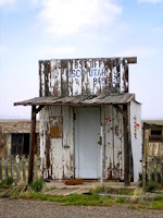
We backtrack back to the highway and head south again towards I-70. We take a short detour south of Huntington, eastward a few miles to the small farm settlement of Lawrence. Here, we see a few crumbling buildings in various states of disrepair, but most of this little burg is still occupied by farmers.

Returning to NV-10, we soon come to Emery, a semi-ghost town. Though still occupied by about 300 people, the town is but a shell of its former self and from what we could tell, only had one open business plus the post office. Interspersed throughout the well-cared for homes, were a number of tumbling barns, an 1898 church, a few closed businesses and a several interesting abandoned old houses.

Continuing southward, Dave is ecstatic when we hit the interstate, and its 75 mph speed limit. At the junction of I-70 and I-15, we make a stop at Cove Fort. Not a military fort, but rather a Mormon rest stop, the fort was established for the protection and refreshment of travelers in the mid 1800's. However, the fort was never needed for protection against the Indians as the Hinkley family, which built and lived at the location were on good terms with the Paiute. Only one shot was ever fired at the fort and that was accidental. Restored and maintained by the Mormon church today, the site includes the enclosed fort, telegraph office, stage stop, and living quarters. It also includes a barn, bunkhouse and blacksmith shop.

Unlike another stop we made a couple of years ago at the Liberty, Missouri Jail historic site, which was also run by the church, we did not receive a lot of pressure from the very kindly couple that took us on a tour of the fort. In fact, it was very interesting and we much enjoyed it. Unfortunately, on that other stop we made a couple of years ago, we were so surrounded by aggressive church recruiters, that I never even wrote about the place. Maybe, I'll rethink that and write about its history, as it is very interesting. Unfortunately, at the time, I was just so repulsed by the pressure, that unfortunately, I didn't want to "promote" the site. If this has been your experience at other Mormon sites, don't let it stop you at Cove Fort, as it is well worth the stop.

Onward south we "fly" down I-15 to Cedar City, where we veer off once again headed westward down UT-156. We take a short detour at the ruins of Old Irontown, where the Union Iron Company thrived from 1868 to 1877. Once supporting some 100 residents, the site had a foundry, machine shop, brick schoolhouse, blacksmith shop, pattern shop and several homes. Today, the remains of the furnace, a cone-shaped kiln, and one home can still be seen at the state operated site.

We then head south down UT-18 in search of the Mountain Meadows Massacre site. Here, in September, 1857, the Fancher-Baker emigrant wagon train from Arkansas was attacked by the Mormon Militia, with the aide of local Paiute Indians. After a five day siege, an estimated 120 unarmed men, women and older children were killed; 17 of the younger children under the age of seven were spared. Remembering the history and paying our respects, it was a very sad site, but well worth the stop.

The rest of our journey southward back to I-15 is very picturesque as we pass by mountain farms, streams and lakes. Landing for the night in Mesquite, Nevada, our journey is officially over. Tomorrow, it is a straight shot to the Las Vegas airport and we are homeward bound. Stay tuned, as I get all these stops and their history written up in detail.
Happy travels!!

Carbon County Ghost Towns

I've been looking forward to Carbon County ghost towns and old mining camps -- geez, there must be two dozen different former coal mining camps in the county. Though, of course, there is always the history, there are unfortunately not a lot of remains of these many towns - most are entirely gone. Some of this must be due to continued active coal mining in the area, others may have been really small and entirely destroyed by the elements, more were destroyed by the highways; and, yet others have seemingly turned into little mini-resorts, at least around Scofield State Park and its lake. More, such as Winter Quarters and Hiawatha are on private property and cannot be accessed.

Well, all that being said, there are still a lot of remains. My expectations were too high, most likely. But getting past that, we head north from Price towards Helper, but detour at Consumers Road, headed westward to the coal camps of Coal City, National, Consumers and Sweet. Right off the bat, we see active coal mining and do find a few tumbling structures along the road. What camp they once were was impossible to tell. At the end of the road we see active mining once again. Another road continues past, but is muddy and snowy, so we turn around and make our way to Highway 191.

Next stop takes us to northwest on Highway 157 to the old mining camp of Kenilworth. Coal was discovered here in 1904. Two years later the mine was taken over by the Coal and Coke Company and Kenilworth became a company town. In no time, the town sported a company store and dozens of company houses for its mining workers. After the mine closed in the late 1950's, the Coal Company broke tradition and sold the homes to its workers. Today, Kenilworth is still occupied by several hundred people. The old company homes line the streets in various stages of renovation and the old company store still stands.

We then backtrack down the road and head north to Helper, the one time "hub" of Carbon County. Surrounded by coal towns and the local headquarters of the Denver and Rio Grande Western Railway, the town quickly developed into a transportation and supply center. With numerous historic buildings, a railroad and mining museum, and its rich history, Helper is worth exploring.

Next, we're headed west again on Spring Canyon Road, where six coal camps once stood, including Peerless, Spring Canyon, Standardville, Latuda, Rains and Mutual. It's difficult to tell where one mining camp ended and the next began, but we were able to identify several buildings in what was once Standardville, built in 1911 for the mine workers of the Standard Coal Company. Operating several area mines, which continued to produce until 1950, a number of structures continue to stand.

We then return to US-191 and head north. I am disappointed to find that there is nothing left of the old town of Castle Gate, famous for two historic events -- the robbery of the Pleasant Valley Coal Comapny in broad daylight by Butch Cassidy and Elza Lay on April 21, 1897 and the explosion of the Castle Gate Mine #2 on March 8, 1924, which killed 172 miners. Unfortunately, the town was entirely dismantled in 1974 and replaced with coal loading facilities. We can also find no remains of Heiner, Royal or Colton, which were also located along this route.

Taking a westward turn of Scofield Road, we then head up into the high mountains in search of Scofield and Clear Creek. After passing Scofield State Park and its large still snow-covered lake, we come to Scofield. This surprising little town is filled with pristinely restored miners' housing, large brand new homes, crumbling shacks, and several historic buildings. Though technically a ghost town, it is permanently called home to about 30 people and one can see that it is probably a beehive of activity during the summer months. However, on our visit to this high altitude little town, some of the homes still had snow halfway up their front doors and we saw nary a soul.
Continuing a few miles beyond, we come to Clear Creek, which is much like Scofield in its little rows of restored miners houses, but we find no historic business buildings.

In 1900, the nearby mining camp of Winter Quarters (not accessible as it is on private land) was the site of one of the worst mine disasters in American history. On May 1st an explosion in the Number 4 shaft of the Winter Quarters Mine, killed some 200 men.

Backing out of this high country, we then head on back to Price.

Tuesday, April 22, 2008

More Parks and Ghost Towns

Headed southeast from Green River, we make our way along I-70 to US-191 and head southward to Canyonlands National Park. However, before we arrive we make a detour at Utah's Dead Horse Point State Park. There, we peek down some 2,000 feet to the Colorado River as it winds its way from the continental divide in Colorado to the Gulf of California. A baby Grand Canyon, the view is spectacular, but the winds are so high and so cold, we make it a brief stop and move on towards Canyonlands National Park.

The park preserves a colorful landscape eroded into countless canyons, mesas and buttes by the Colorado River and its tributaries. We see many more spectacular views, but believe it or not, we are just National Park "wiped out" and look forward to a different type of scenery. After having lunch in Moab, we skirt the Arches National Park along the Colorado River, making our way to our first ghost town of the day - Cisco, Utah.

Cisco started as a watering stop for the Denver and Rio Grande Western Railroad in 1866. Before long, a number of businesses sprang up to accomodate travelers and the area became a ranching community as well. In 1924, oil and natural gas were discovered in the area and the town continued to grow, reaching a population of about 400 in the 1940s. However, when the town was bypassed by I-70, it declined rapidly. Today, it is filled with numerous closed businesses and crumbling houses. We spied just a few late model vehicles, but during our visit, saw nary a single person, not even a roaming dog. For whatever reasons, Dave is "creeped out," sure that some hairy beast is going to come crawling out of one of those many abandoned buildings, kidnap us, and have us for dinner (or something.) Me thinks he watches too many scary movies, but we're off!

Back to I-70, we're headed westward to Thompson Springs, where we plan to travel north to Sego Canyon for a view of Indian Petroglyphs and onward to the old mining town of Sego. We are in for a "treat" when we find that Thompson is also a ghost town. Though there are people that live here, the town is just a shell of its former self and sports no open businesses. We continue through town to Sego Canyon for a view of the petroglyphs, then to the Sego Cemetery, and the remains of Sego, itself.

The old coal mining town has a number of ruins including the stone general store, the crumbling boarding house, and a number of other outbuildings, mine shafts, and bridges. It was a great stop and much needed for these National Park weary travelers. Isn't that terrible! Utah has so many national parks in this part of the state, that we've grown bored with them.

On to Price, Utah for the night and more ghost towns tomorrow.

Sunday, April 20, 2008

A Land of Extremes

We are in for a day of visual and physical extremes that are awe-inspiring and startling in their intense temperature and landscape changes, take a look:

A Kane County sprinkler left on over night freezes everything in site. It's a beautiful sight and we're intrigued as we see this practice over and over as we travel north from Kanab on U.S. Highway 189. Certainly, there is a purpose, other than providing us a picturesque view, but I haven't a clue as to what it might be. Though a sunny morning, it is quite cold and we're running the heater and taking photos from the car windows.

Through here, we also spy two more of the quirky dummies in police and sheriff's cars. It does work! Dave is slowing down immediately as we spy the first. Though we had just seen one last night, it didn't occur that it might also be happening some 30 miles to the north. He, of course, slows down again when we see the second. Yup, it was a dummy. A few miles later, another.

We are wowed once again in Bryce Canyon as we view the thousands upon thousands of towering red spires, called "hoodoos," which have been formed over the eons when ice and rainwater wear away the weak limestone. We are wearing jackets, but it's not uncomfortably cold, even though snow shows up on many of its towering spires.

We continue our journey along Scenic Byway 12 to Cannonville, where we travel south through town in search of the ghost town of Georgetown. All along here, there were once a number of Mormon settlements. However, a lack of water, and too much water (during flash floods) did them in. Of Georgetown, there is only one small cabin and a cemetery. The side road to the cemetery provides more views of a crumbling house and this old truck, obviously caught during a flash flood many decades ago. This whole area is dry and desolate. We are peeling off the jackets and pushing up the shirt sleeves as we trod through fine sandy soil and turn away from the many dust devils that seemingly appear out of nowhere.

Returning to Scenic Byway 12, we begin to see numerous "patchwork quilt" type views at the Grand Staircase-Escalante National Monument. This vast wonderland, which covers some 1.9 million acres, not only provides scenes of the multi-hued Kaiparowits Plateau, but also rugged cliffs and canyons. We feel as if we've landed on another planet in this remote and strange looking region. In fact, it is so vast and remote, it was the last place in the continental United States to be mapped.

Continuing our journey, we soon come to Boulder, where we visit the Anasazi State Park Museum. Here, was once one of the largest Anasazi communities west of the Colorado River and the most northern of all the Anasazi communities. Excavations have revealed that there were once more than 100 structures here. Partial excavations can be seen at the site as well as numerous artifacts and a recreated structure.

Onward north over Boulder Mountain, we are unprepared for the quick rise in elevation and are astounded by the amount of snow still lying in the meadows. Boulder Mountain exceeds an elevation of 11,000 feet and is the highest timbered plateau in North America. As you can imagine, by this time, our jackets are back on, the heater is running in the car, and all photos are being taken from the windows.

We're relieved to be off that freezing cold mountain as we near Torrey, Utah where Highway 12 ends and we head eastward on Highway 24 to the Capitol Reef National Park. Once again, my neck is craning toward those towering red monolithes and huge dome formations as we head for the ghost town of Fruita, located in the midst of the national park. This old Mormon settlement, though surrounded by vast wildneress and desert, was an oasis in the midst, where fruit trees and crops flourished along the Freemont River. Settled in the early 1880's, people actually continued to live here until 1959, some 14 years after the town was absorbed by the National Park. Though many of the buildings that once supported about 10 families were razed, the site still displays its old schoolhouse, a home, a barn, a few outbuildings, its beautiful orchards and some horses.

And here, comes my adventure for the day. For some strange reason, animals tend to be attracted to me - usually in a good way, but not always. I have numerous bizarre stories during my life time, from a quiet bear I was amazed to find sitting behind me as a sat unmoving on a swing in the New Mexico mountains, to a monkey flying across a cage in a zoo to display an obscene physical gesture, to horses and cattle that cross fields towards me as I get out of the car. On one occasion as I watched buffalo behind a chain link fence with dozens of other people, the chief male of the herd came blasting across the field to ram the fence right in front of me. Even when I moved, he would continue to blast that fence at where ever I stood. In any event, I've never had problems with horses. They tend to search me out, and come pleasantly to me, but not in old Fruita. Just after we parked the car near the corral, a white horse made a beeline to me. I reached out and petted him and talked to him for a little while, when suddenly he bit me on the arm! I was so astounded, I didn't even scream. Just pulled away and Dave said my eyes were as big as saucers. Don't go near the white horse.

We then continue on to take an additional Scenic Drive through the park that provides access to the Capitol Gorge and several other areas. We take the Capitol Gorge spur road into the canyon, along a historic path where the hardhy pioneers once traveled. At the end of the road, a trail leads back into the canyon that will provide peeks at petroglyphs and the Pioneer Register where early travelers recorded their passage on the canyon walls. Though it was a two mile round trip hike, it was worth the trip.

Though a great day, it's been a long one and we are anxious to find a hotel. Continuing our journey on Highway 24, we are hoping to stop in either Caineville or Hanksville, but, yikes, these are pretty much ghost towns. We spy just one or two seedy looking ma & pa typelodging facilities, but there are no restaurants and certainly no wi-fi. Arrgh, another 60 miles. And, we find ourselves in yet another place that we are absolutely sure is on another planet. As the sun is waning, we drive through miles and miles of what looks like huge piles of gray sand looming from the desert floor.
Finally, Green River, hotel, and delivery pizza!

Utah - The Beehive State

Utah! The Beehive State, symbol of industriousness and the pioneer virtues of thrift and perseverance. Well, we'll have to see about that. This is my first "real" visit to Utah. Sure, in my past lifetime, when I traveled for business, I had a few quick stops in Salt Lake City, but I've never been here as a tourist. Man, oh, man are we in for a treat, but that doesn't make itself apparent right off the bat. First stop, a tourist information center in St. George. A clearly marked sign on the highway gives us the exit, another sign sends us eastward and then nothing. No more signs, no buildings marked tourist information center. Hmmm. Turn around, head to a local gas station for directions. The poor lady, very nice, is sighing heavily in response to the question. Seems as if everyone looking for the tourist information center has to stop and ask where it is. Oh, we passed right by it - a clearly marked building that indicates BLM Land Office and Recreation Center. Now, to me (and obviously everyone else) that doesn't mean "Tourism or Welcome Center." Then go in, this looks more like a book and map store than any tourism/welcome center I've ever been to. Where are the state published maps and guides? Where are the many brochures published by the attractions, the National Parks, etc? We ask. Oh, they're in a cabinet behind the counter. Might just have to drop a line to the Utah Tourism Bureau. Not very "industrious," not very welcoming.

Oh well, onward we go. First stop, a small ghost town called Silver Reef. Obviously a silver mining town during its heyday, there's not a lot there, but still well worth the trip. The old Wells Fargo Express Office serves as a gallery and a museum. A powder magazine remains intact, the old bank building still stands, and the Cosmopolitan Saloon has been rebuilt and now serves as a restaurant. In the gulley behind the town, numerous ruins and the old mine continue to speak of more prosperous days. Nearby are two cemeteries, one Catholic, one Protestant.

We then begin our trek eastward and just beyond Toquerville, at Ash Creek, I get see my first ever Shoe Tree. Now, I know these things are all over, but I've yet to run into one, so of course, we make an immediate stop for photos. Just a little start for "Quirky Utah."

Next stop, Virgin, Utah, where I can't resist having my picture taken beneath the city sign. Talk about quirky, huh? Then more eastbound, where we begin to see the beauty that will present itself at Zion National Park. In Rockville, we take a detour south and back westward to the old ghost town of Grafton. Quite a treat, this old Mormon settlement, in a scenic hidden valley, once was a thriving farming community. Today, it continues to display its 1886 school house, several historic homes, and a cemetery. Dave and I think the place is so beautiful and romantic, we can just see ourselves settling down in the pristine little valley.

On to Zion National Park, we are "wowed" by its soaring red monoliths and cragged rock formations created by Mother nature over the eons. Final destination Kanab for the night where we are greeted by some very nice folks, but also treated to our next bit of Utah quirkyness when we spy a dummy in a city police car parked at the side of the road. Now this attempt to get drivers to slow down obviously works because we get to see a few more of those lifeless cops in cars over the next day.

Saturday, April 19, 2008

Just a Little Route 66

With plans to redo just a short stretch of Route 66, I head south out of Las Vegas on US Highway 95, with plans on hitting Searchlight, an area ghost town that I have apparently missed. Ahhh, now I see why I missed it on previous trips, it's not a ghost town. It has a McDonalds, for goodness sakes. Well, it is an old mining town and it doesn't take a lot to find some remaining remnants here and there. Today, however, it is a Colorado River and Lake Mohave access point, so a few hotels, casinos, and several other businesses thrive, as well as numerous modern homes. Still an interesting stop and I found a couple of photo opportunities.

I continue south to Needles, California, passing west bound historic Route 66 that moves toward Goffs, Essex and Amboy, California. I have still not decided whether I will redo that stretch or venture on east into Arizona. After retaking some shots of Needles; however, I find myself continuing eastward. Guess my subconscious mind made that decision and the next thing you know I'm crossing the Colorado River and heading north to Oatman, Arizona.

I love that town! I was glad I made that decision; the other trip I think would just have been too much for a day trip. I amble around, taking pictures of the donkeys, have a great Indian taco, buy about 200 postcards and amble on up the old highway. Next, I see that Gold Road's gold mine tours are all shut down. Didn't know that, will have to update the website. Then, when I stop at Cool Springs, I learn that the Gold Road Mine is getting ready to open back up for business.

On through Kingman and on my way back to Las Vegas. I can't stand to "fly" by Chloride without making the four mile detour. Though I've been there before, I missed the murals painted on the rocks and just had to dash back in for another view. Back on the highway, traffic congests near the Hoover Dam and security is tight with a forced stop and checkpoint. Good, our Homeland Security people are doing their jobs!! Traffic gets even worse as I near Las Vegas and my faithful "friend," my TomTom GPS navigator, who I actually call "Kit" for the explorer, Kit Carson, gets me lost and dumps me right on the Las Vegas Strip in the middle of rush hour traffic. Arghhhhhhh!! That was painful. I'm not staying on the strip, and getting myself out of that mess took almost an hour before I finally make it back to the hotel. In the meantime, Dave says he'll meet me in the room at the Hilton. "No, Dave, there's a bar just inside the casino, I'll meet you there!"

Tomorrow, it's onward to Utah!!

Thursday, April 17, 2008

Headed to Utah

On to another adventure -- we'll see if I can do any better this trip at keeping up with the blog. I just tend to try to cram pack my days so full, that by the time I'm back to the hotel, I can barely do more than eat and die. In any event, I'm off to Las Vegas, Nevada this morning. No, I'm not salivating at the mouth to stick my dollars into a slot machine or sit across from some bored to tears blackjack dealer. But, Sin city is just where Dave happens to be at the moment. Every year, come April, he attends a big convention in Las Vegas. I usually go in towards the end, day trip for a day or two, then he and I take off for somewhere else. This year, the ultimate goal is Utah and its many National Parks in the southern part of the state, along with, you guessed it, a whole bunch of ghost towns.

I've got two days on my own first, but have just about exhausted every day-tripable destination from Las Vegas - I've done this too many times before. But, there are a couple of more I haven't seen, so today I am looking for Goodsprings, a ghost town, and a place called Red Rock Canyon, which really looks more like a great big pile of rocks. But, Dave says I'm enamored with rocks so, it oughta be a good day. Tomorrow, I plan to venture on over to California and redo a little stretch of Route 66 before heading back to Vegas. Next day, we're out of there and on to Utah. Will keep you posted!!

Hours later ...

Well, I made it with relatively little hassle, on-time flight, terrible landing, and a 45 minute wait at the gate, but all safe and sound. Then, off I go. p.s. -- If you're headed out of Vegas, want to avoid the congestion, and think you'll stop for something to eat or drink on the way, think again. Grabbed some chips and a soft drink at a gas station and on to Goodsprings.

While this place is a shell of its former self and is technically a ghost town, it's certainly not empty. It's most famous spot -- the Pioneer Saloon is still open and on a Wednesday afternoon in April, doing a brisk business. Though there are a number of old buildings that continue to reflect Goodsprings' more prosperous mining days, a number of new buildings and restored structures also fill the town of about 200 residents, many of which are most likely Las Vegas commuters. In any event, it was such a great stop and I was having such a good time visiting with the locals, I never made the rest of my planned journey.

So back to Vegas, hotel, some eats, and bed soon. How terrible is that?? I'm in Sin City, with every recreational opportunity that a person can buy, and all I want to buy is room service.
Perhaps tomorrow will be a more interesting story.